I returned on Friday from a workshop in Boulder, Colorado on developing the next generation weather prediction system. Such a system would be essentially probabilistic in nature---rather than giving a single answer as we do today. It really doesn't make sense to say the high temp at Seattle in seven days will be 67F--there is substantial uncertainty in the answer and that uncertainty depends on the situation. My field is developing the technologies to provide uncertainty information--including probabilities of much more than precipitation. This is a major revolution in the way we do business. But is the population ready for this? Will they accept and use it?
While I was in Boulder it snowed! On Wednesday, there were snow flakes in the air, with temperatures dropping into the upper 30sF. Being over 5000 ft and open to the cold air to the north really helps.

This weekend will be moderate in temperature and very nice here in the NW. Look at the latest satellite image (above). You will notice some residual low clouds from a dissipating front that moved through this morning. But skies will clear and temps should rise into the mid and upper 60s for most of the west.
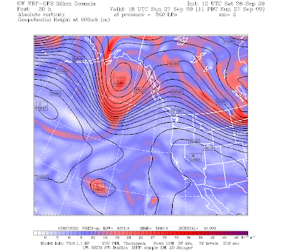
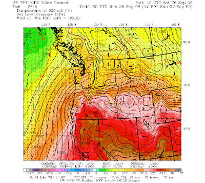
Tomorrow will be even nicer. High pressure (ridging) will develop aloft and its surface manifestation will be high pressure to our east (figure). You know what that implies...offshore flow and compressional warming as air descends the western slopes of the Cascades (see figure). Our friend the thermal trough will be back. So tomorrow will be sunny with many temps rising into the upper 60s and lower 70s.

Monday really won't be too bad. A week front will approach...but will not arrive until late in the day. Thus, most of Monday will be dry, but with increasing clouds and chance of showers very late in the day.
Tuesday should be cooler and showery...but really nothing to write home about.
So enjoy a very nice weekend....
Tidak ada komentar:
Posting Komentar