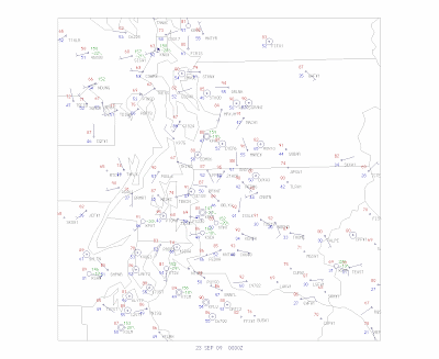
Today was hot, with many locations getting into the mid and upper 80s, and some foothills locations reaching into the 90s (see map of temps and winds at 5 PM). Why the foothills? The reason is we had fairly strong easterly flow today with downslope flow and compressional warming of the air descending the slopes. (see Seattle profiler winds and temps to see the easterly flow and warming aloft). North Bend is a favorite place for hot temps on such days because it is at the
 base of the Cascades and gets the maximum downslope heating. Hint: during the late fall it is sometimes MUCH warmer near North Bend and the foothills than anywhere else--good place for a hike or bike ride!
Last night there was good radiational cooling to space (since we had clear skies) and temperatures fell over most of the region...but near the foothills the temps really held up due to the downslope. See for yourself with the weather map at 7 AM. Over 70F in the foothills...but in the 50s and 40s elsewhere!

Another interesting aspect of temps today have been the large diurnal (daily) temperature range...something we frequently see in the fall under these conditions. With full sun and downslope offshore flow the temperatures can still get quite warm during the day, but the nights are getting much longer now (unfortunately for my tomatoes), and with clear skies there is good radiational cooling to space. Today, many locations were in the 40s this morning and skyrocketed to near 90F....nearly a 50F change over roughly six hours. That will crack some concrete! Don't believe me? Take a look at the temps at Shelton today (graph), where the temperature climbed from 41 to 89 over a few hours!

Tomorrow (Wed) will be slightly cooler and a marine push will occur tomorrow night....ending the heat wave. But no major weather in sight.
Tidak ada komentar:
Posting Komentar